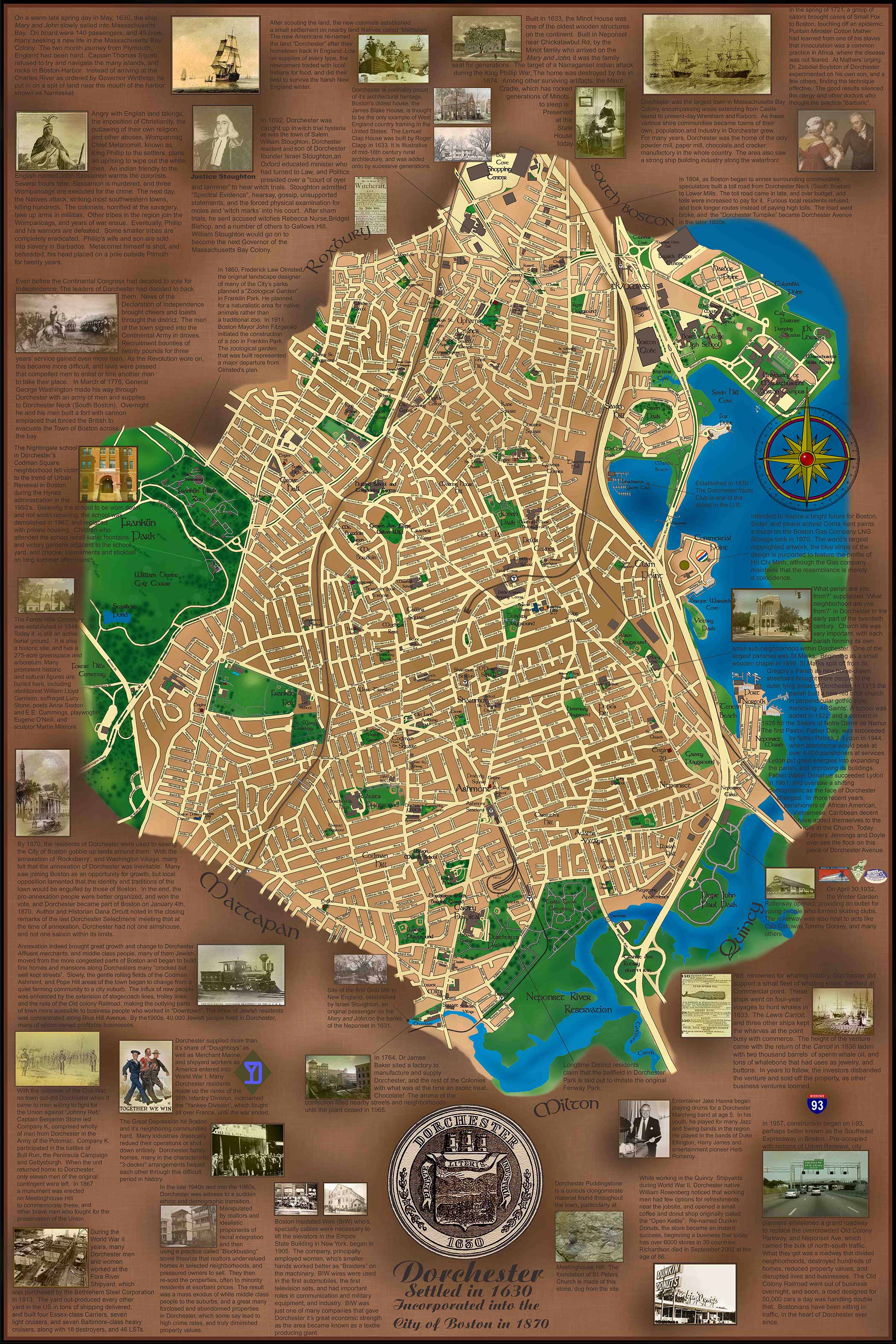
Close-up detail of the Dorchester Modern neighborhood historical map
Dorchester
Modern neighborhood

Neighborhood Atlas

Dorchester

A long north–south portrait of Dorchester: settlement, annexation, farms, mills, Commercial Point, and the many layers of the neighborhood.

CollectionNeighborhoods
Edition / eraModern neighborhood
Print format24 × 36 in
OrientationPortrait

$125 Shipping: $25 · Massachusetts sales tax: 6.25% where applicable

View map details

Interactive map room

Explore the map in detail.

Use the zoom controls, mouse wheel, or trackpad to inspect the map. Once zoomed, drag the image to move around the page.

Dorchester Interactive map viewer
100%
Full map view of Dorchester
Scroll or use +/− to zoomDrag to pan after zooming

High-resolution detail

Study the lettering, illustrations, and historical notes up close.

This enlarged section shows the fine detail, image work, annotations, and hand-drawn character of the finished map.

Open high-resolution detail ↗

The story on the map

A closer look at Dorchester.

Dorchester developed as a substantial town with an identity of its own before annexation to Boston. This portrait-format map follows its farms, Neponset River mills, waterfront activity, and later urban growth while preserving the neighborhood’s many distinct local centers.